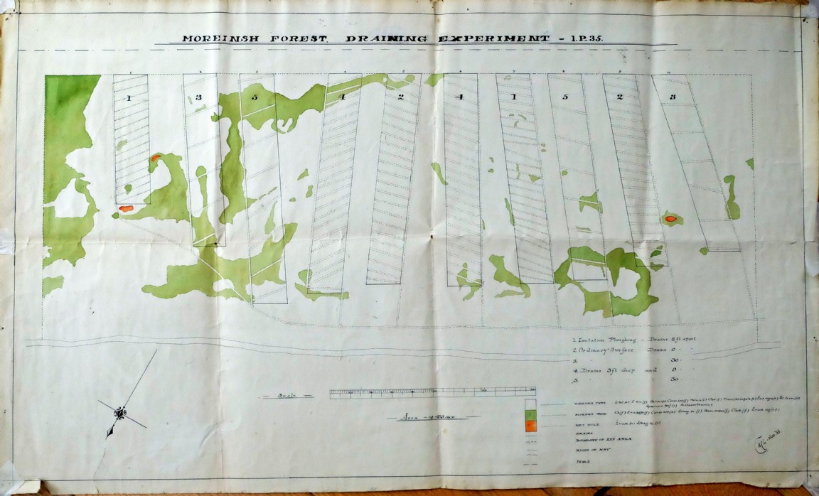
Draining Experiment at Moreinsh Forest – 1935
This map image was part of a collection passed to Forestry Memories from a storage shed in Newton Nursery used by Forest Research.
The skills of the cartographer are beautifully illustrated in this map drawn on quite stiff paper. The initials in the bottom right hand corner may be CACG or just ACG - Nov ’35 (See large image link below for more detail)
The more one looks at the detail on this map, the embellishments around the north arrow, the minute detail of the scale rule, the different text lettering and the convoluted green areas representing the scirpus grass communities within the heather, one wonders how much time was devoted to the survey of the site and then the preparation of the map.
Five replicated draining treatments are represented by the map:
1. Imitation Ploughing – Drains 8 feet apart
2. Ordinary Surface – Drains 9 feet apart
3. Ordinary Surface – Drains 30 feet apart
4. Drains 5 feet deep and drains 9 feet apart
5. Drains 5 feet deep and drains 30 feet apart
The experiment is laid out on a Culluna site (Heather with all component species listed) interspersed with low nutrient scirpus grass areas and wet bog holes. Again the abbreviated species names are listed. The individual plots are over 200 feet long and probably around 40 feet wide.
Is this the Forest area near Glenlivet in Morayshire?
Foresters were aware that drainage and cultivation on peat produced results and that on firm ground, tractors and ploughs made afforestation easier and potentially much cheaper. As high and modest quality land was prioritised for agriculture, to expand forestry it was essential that methods and ways were devised to turn lower nutrient and wet land into productive sites for afforestation. Hence the long search for tree species that would tolerate and grow in the hostile conditions, ground cultivation treatments that would enhance the growth potential of these species and fertiliser types and rates that would assist establishment.
Download Large Version (546kB)
Groups: Forest Research, Forestry Records, Booklets and Reports, Maps of Forest and Woodland Areas