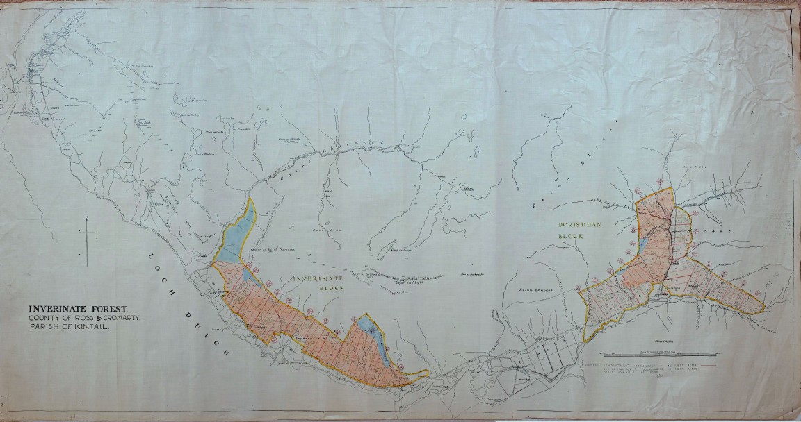
Inverinate and Dorusduan Forest Map
One of a series of maps and drawings found in old ex military map cases stored in the loft of the Fort August Forest office and recovered by Grant Macintosh.
The hand drawn map on linen paper depicts the two forest areas fully planted as at around 1951 with the last planting finished in 1942. If comparing with the acquisition survey maps the fence boundaries and the actual unplantable areas are very similar. The original plan was followed fairly closely. From personal memory the higher part of Dorusduan Forest (on the right) was quite badly stocked, very open and severely damaged by red deer as at 1978.
The signature of the cartographer is taken to be that of David T Seal who may have been a junior District Officer in the area around 1951. Can anyone confirm?
Download Large Version (5.6MB)
Groups: Maps of Forest and Woodland Areas