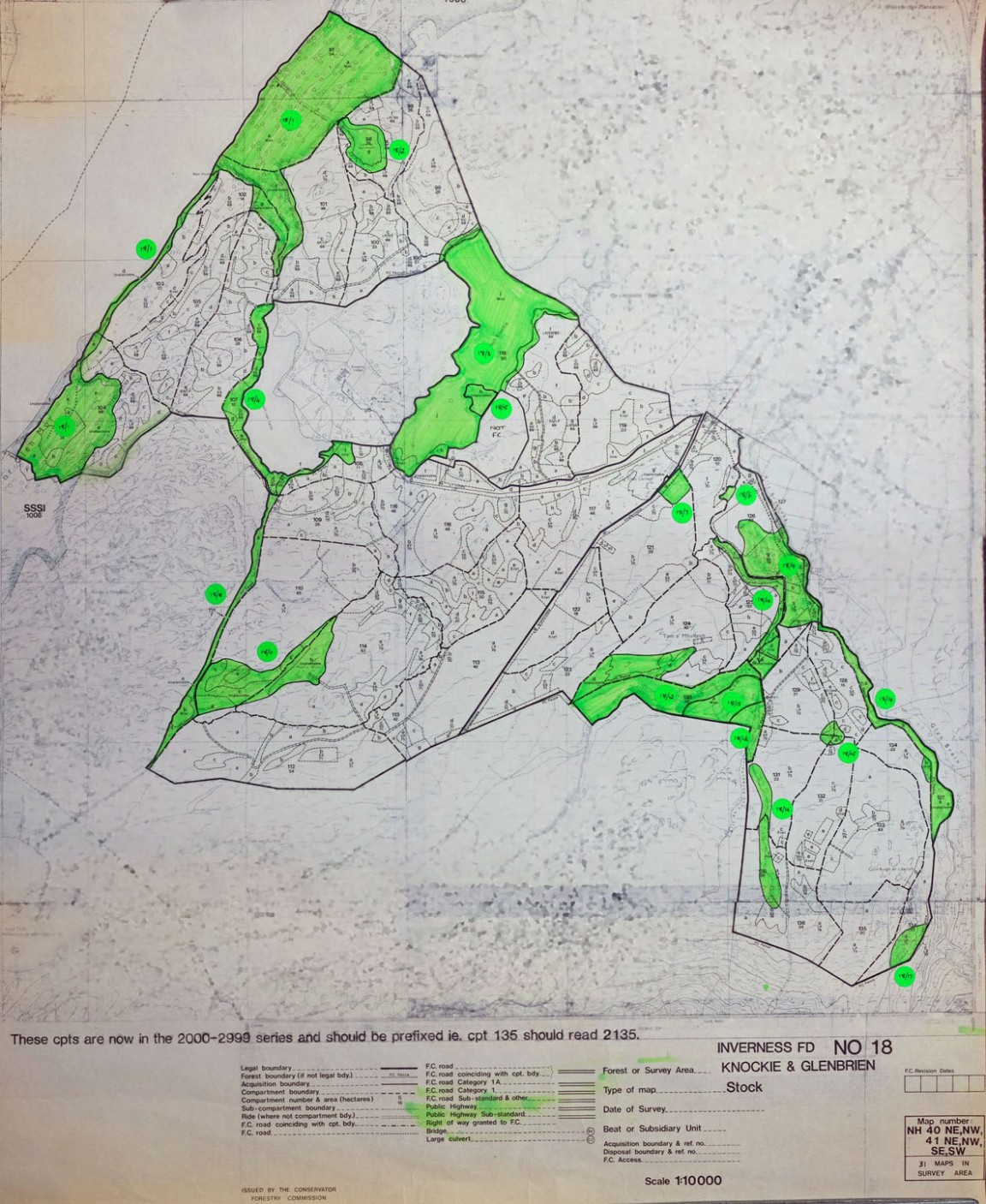
Knockie and Glenbrien Forest Maps – East side of Loch Ness
One of a series of maps and drawings found in old ex military map cases stored in the loft of the Fort August Forest office and recovered by Grant Macintosh.
This map is one of at least 18 forest maps covering the then Inverness Forest District about 1985. The actual detail of the forest was surveyed about 1976 but compartment numbering has been updated from that of the original separate forest unit (Farigaig Forest prior to 1983).
The green highlight and numbering is an early process of identifying areas with actual or potential conservation value which were then listed in a schedule with some brief notes on their features and a management prescription. Here they feature mainly unplanted areas or open hill tops but birch woodland and riparian areas are also included. This action followed on from a rising awareness of the increasing value of a wide range of conservation work and objectives within the forest managers’ portfolios.
The forest area is on the east side of Loch Ness and has compartments that run from number 97 to 136 and planted in years 1968 to 1973.
Any details and stories from working in this forest area would be very welcome.