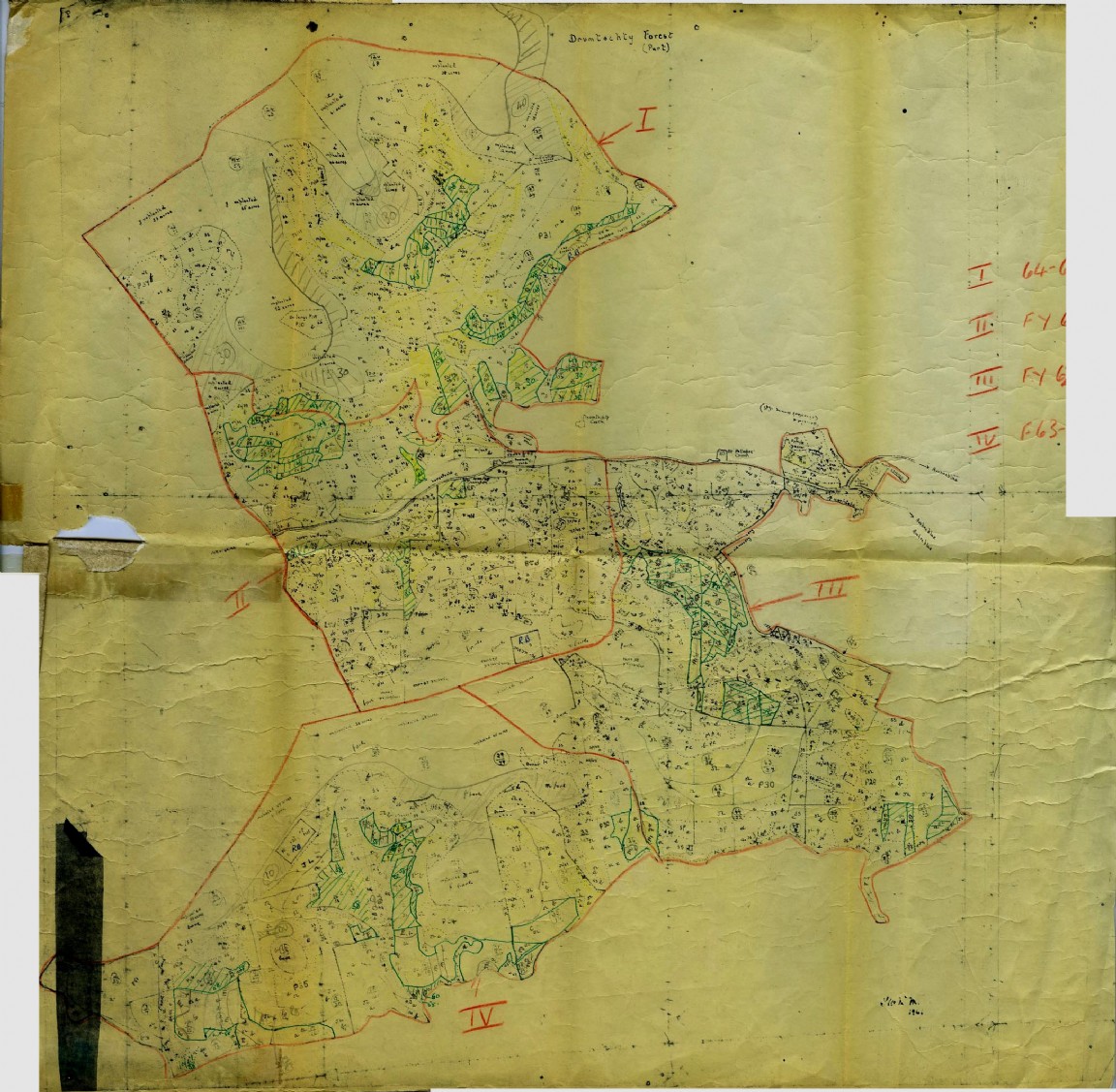
Drumtochty Forest Working Plan circa 1963
The planning papers and map is courtesy of Moray and Aberdeenshire Forest District. No full plan has been uncovered but the attached PDF shows many of the working plan forms that were compiled annually to plan and forecast the work programmes and resources for one forest in this case Drumtochty. Noted below they range through:
WP10 Record of Acquisition and Disposal areas
WP11 Statement of land Utilisation
WP13 Record of Past Yields from Thinning
WP13 Record of Past Yields from Felling
WP14 Forecast of Quantities (Planting Ploughing Thinning Felling etc etc)
WP15 Summary of Forecasts and Reconciliation of Labour (Annual estimated of worker man years)
WP17 Short/Long Term Forecast of Thinning
WP17 Short/Long Term Forecast of Felling
WP18 Production Programme and Control of Thinning
WP18 Production Programme and Control of Felling
WP21 Long Term Forecast of (Timber Volume) Increment and Thinnings
Note that the map image is that of a hand drawn stock map sectioned off into four Thinning Blocks of which I is for 1964/65, II for 1963, III for 1962 and IV for 1963/64.
It is very difficult today with computer aided processing and digital storage where unimaginable volumes of data can be called forward at the click of a mouse and processed in many different formats to then imagine the pre electronic era of the above with countless hours of manual and mental number calculation for estimates that entailed the normal process of recording the work and forecast predictions of a forest unit.
Behind the WP forms were many sheets of note paper where areas of compartments were listed and further broken down by species, area and age. Even keeping track of the areas of land by land use category such as new planting, forest worker holdings, unplantable, burnt, felled, forest research areas, forest nurseries all required laborious measurement with tape, chain and compass and then recorded on maps and WP form without the aid of calculators, adding machines or planimeters!
How easy would it be for us today to run a pencil point up a page length of figures and quickly arrive at an accurate total at the bottom? Can we still do the long division and multiplication sums necessary for areas, volumes, volumes by area and so on?
Some of the forms are signed, one set of signatures being that of the then District Officer – Jock G Chrystall (later Assistant Conservator North Scotland) and others by forester W McDonald.
Note that the PDF image can be turned on the screen by going to the Chevron on the right hand side of the dark bar above the page.
Download Large Version (1.1MB)
Groups: Maps of Forest and Woodland Areas, Northeast Scotland