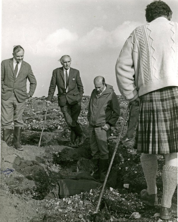
Description of soil profile from the soil pit
Photograph courtesy of David Paterson, Edinburgh.
Obviously fascinated by the work going on down in the deep hole!
David Paterson in his Site Survey days is demonstrating to the assembled personnel the details of the profile of the quartzite soil on summit saddle between Balloch and Meikle Balloch (Balloch Forest nr Keith). Photograph was taken by David Foot.
Lined up from the left are Bob Cathie (Asst Conservator, Forest Management, East Scotland), Bob Allison (Chief Forester, Speymouth Forest), Dick Richards (Conservator, East Scotland), and standing with back to camera, Finlay MacRae (District Officer visiting from Dingwall).
For obvious reasons, forestry staff needed to take a close interest in the soil on which they were planting new forests. Soils across Scotland vary enormously in quality, fertility, moisture retention and compaction. On the increasingly more difficult sites that were made available to forestry, care was required to ensure that appropriate cultivation methods and tree species selection were robust for all the conditions encountered in order to ensure that plantations were successful.
To this end there was a strong drive to develop the science of vegetation species recognition, its associated site soil profile description and to each of these the matching of appropriate cultivation methods and the range of tree species most likely to succeed in providing a viable tree crop.
One half of the process was the formation of teams of staff, Soils Survey Branch, who dug 1000s of soil pits over potential and existing forestry sites. Using this information and that of associated vegetation distribution patterns they drew up detailed forest soil maps covering a great many forests over Scotland. Each of the area segments within the map was assigned a soil type code although often with a proportion of other soil types present added in brackets. Sometimes a soil type code covered only an acre (or hectare) or so but usually the area could be larger and up to 10-50 hectares in size with many discrete sections replicated across a whole forest.
The second crucial part of the process was the identification of the most robust cultivation methods and tree species suited to the different soil type codes. To achieve this, hundreds of replicated experiments were set up and the process of carrying out detailed analysis of older existing forest crops was completed before the publication of tables of soil code types with the recommended cultivation and species choice for each.
The last link in the chain was the training of foresters responsible for planting to recognise some of the different vegetation and soil types and to use the maps and publications to guide them into the best general cultivation method and tree species selection for a forest. It has to be said however that the laws of supply and demand applied to machines and plant supplies and there were times when the most appropriate was just not available!
Groups: Forestry Areas, Forestry in Action, Groups of people, Northeast Scotland