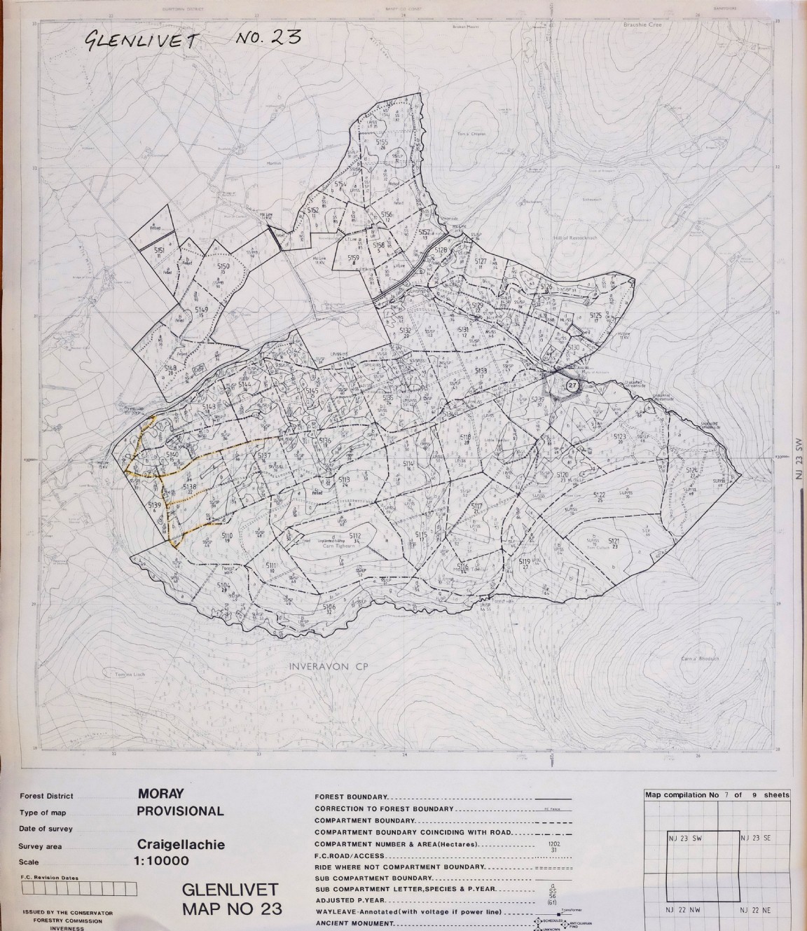
Craigellachie Forest – Glenlivet – Speyside Forest District
The map was recovered from shed at Newton that acted as a storage area for Forest Research who used the maps to locate forest and tree experiments in the field.
Craigellachie Forest formed in 1971/72 by amalgamating parts of Bin, all of Elchies and part of Rosarie Forests. In 1981/82 Glenlivet Forest was added to Craigellachie Forest. Following the formation of Forest District units in 1982/83 Craigellachie was amalgamated with part of Speymouth Forest to form Speyside Forest District based in Fochabers.
This forest area shown on the map is close to Tomnavoulin in Morayshire and at the point where Glenrinnes joins Glenlivet. It is suspected that the forest map survey of the forest was carried out at some point in the early 1980s and updated to at least 1991 the most up to date planting year noted. The oldest trees (not felled at this point) were planted in 1933 in Compartment 5126 and 1931 in Compartment 5154. Later plantings up the hill were carried out ion the 1950s and 1960s all as part of Glenlivet Forest.
There is a forest car park (and forest walk) annotated in Compartment 5143. Any details on this forest area and its local name would be very welcome.
Download Large Version (4.9MB)
Groups: Maps of Forest and Woodland Areas, Northeast Scotland