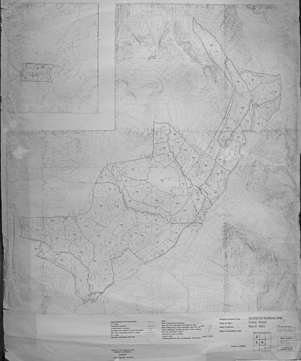
Lorne Forest District Map – Former Loch Etive and Glencoe Forest Areas updated to 1991 – Map 6
The map was recovered from a shed at Newton Nursery which acted as a storage area for Forest Research who used the maps to locate forest and tree experiments in the field.
Loch Etive Forest was named and initiated around 1959-1960 and administered by forester J H Rodger at that time. In 1972 a process of general restructuring of forest areas resulted in the amalgamation of Loch Etive (Glen Etive) as shown here into Glencoe Forest (also included Glen Duror). In turn 12 years down the line Glencoe along with several other forests were then formed into a Forest District structure - in this case Lorne Forest District in 1984/85. The Compartment numbering is in the 3000 sequence to denote its original link into Glencoe Forest but in the 3500s to specifically identify the Loch Etive area in this forest map survey. Does anyone know why the name Loch Etive was originally chosen as the Forest name rather than the apparently more appropriate Glen Etive?
The planting years extend from 1960 up to 1970 with some small local area of older Scots pine and larch (1895 - 1900) and small patch of Sitka spruce planted in 1950 in compartment 3558. Note that there are some irregularities in the map lines due to scanning in several sections and rejoining together.
Keith Miller, former Forest District manager for Lorne, writes “Glen Etive (as distinct from the Barcaldine outliers on Loch Etive side) did have some FC infrastructure - Foresters house, Forest Worker Holdings, Depot and even a Displaced Persons Hostel (occupied by Polish Nationals unable to return to post war homes and employed to plant up Glen Etive). These are all clustered around compartment numbers 3529 and 3530.”
Any more details and names would be very welcome - Please see large image link below.
Download Large Version (11.5MB)
Groups: Maps of Forest and Woodland Areas