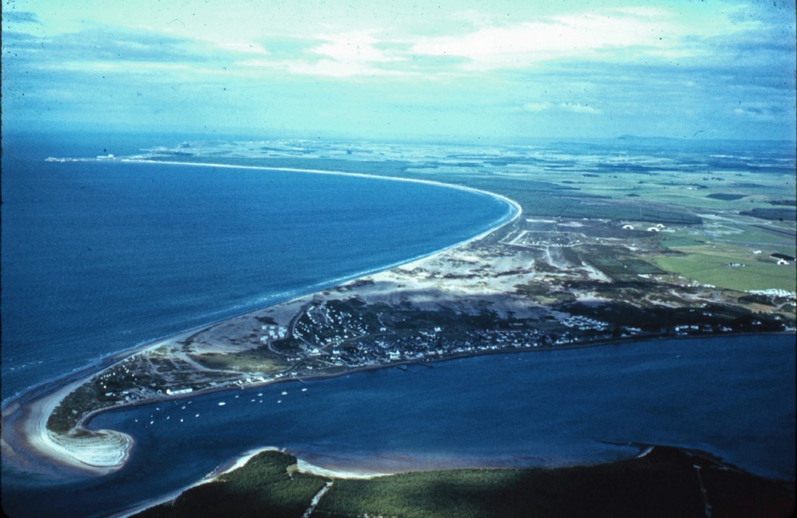
Aerial view of Findhorn Village and Roseisle Forest
The image is from a collection of slides and photographs ‘rescued from the skip’ and handed to Forestry Memories. Generally very little information with or about them and for details we will have to rely on readers’ memories or geographical knowledge.
However this stunning aerial view location is very recognisable. In the foreground just in view is the eastern edge of Culbin Forest with the estuary bay of the River Findhorn at high tide running down between the forest and Findhorn Village.
Beyond the village is the graceful sweep of Burghead Bay as it fronts Roseisle Forest leading to Burghead village in the distance. Kinloss former airfield runways and buildings are just visible on the right.
Note the curves of shingle showing up between the village and the present day river mouth indicating former river mouth positions.
Comments welcome.
Download Large Version (444kB)
Groups: Aircraft in Forestry Work, Forestry Areas, Northeast Scotland