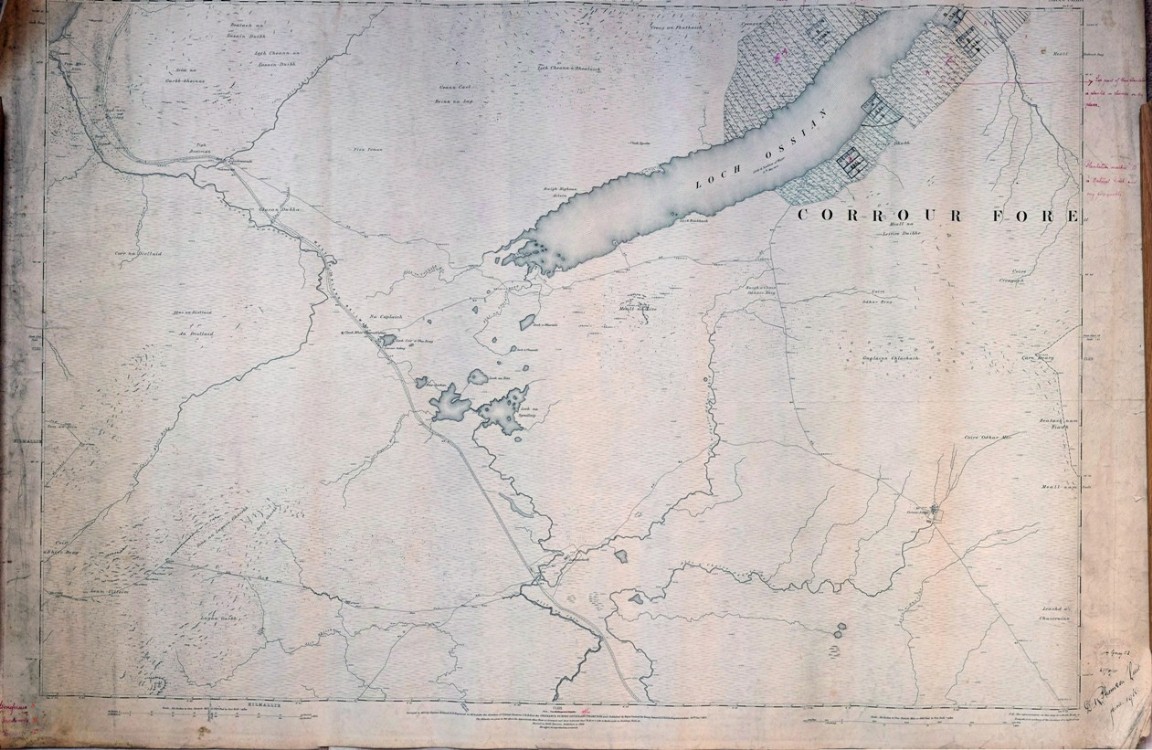
Woodland census 1918
One of a series of maps and drawings found in old ex military map cases stored in the loft of the Fort August Forest office and recovered by Grant Macintosh.
The details of this census are not known so far and any information is most welcome. This could well have been one of the first full national woodland surveys of UK or GB and may have been undertaken by military staff as the signature in the bottom right hand corner is that of D R Thomson (Lieut) dated June 1918.
The details on the stamp above the signature are unclear but are that of the Board of Trade Timber (Office or Officer or Department –hard to make out?) There is a second signature below the word Surveyor of that of William Gray C2 with address possibly reading as 1 Queen Street but city name is unclear. It could read as Aberdeen, London or some other. Again any suggestions welcome.
The actual census area and location is that of part of Corrour Estate and covers some of the forest areas established by John Stirling Maxwell and his staff over the previous 35 years. The notes in the margins read as ‘Top part of this plantation is planted in clumps on dry places' and also ‘Plantation marked as ‘B’ is Natural Birch and very poor quality’. A note in the bottom left hand corner indicates that A refers to Coniferous, B to Hardwoods and C to mixed woodlands.
See large image and also signatures in the attached PDF
Can anyone provide any more information?
2 Comments
I plan to ask the Highland Archive Centre if they wish to take custody of the original maps. You can email me direct at nandh.davidson@btopenworld.com Comment left on 15 April 2019 at 19:58 by Norman Davidson