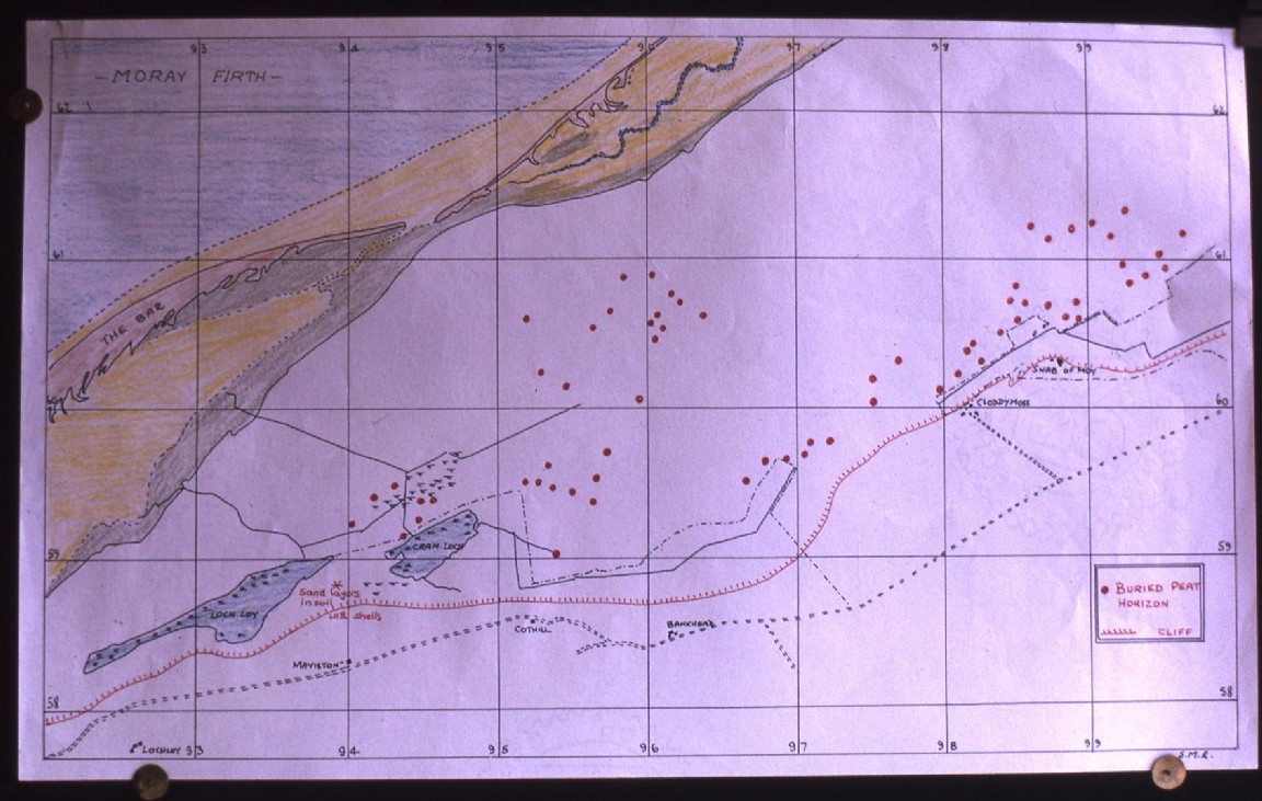
Buried peat & agricultural surfaces - Culbin
Sinclair M Ross a former meteorologist with the RAF had a very strong interest in the geological processes and development of the Culbin and Findhorn areas.
The map shows areas on the western side of Culbin Forest where the Forestry Commission soil survey team came across areas of buried peat horizons when they were digging their soil pits to enable a soil map for the whole forest to be produced. Over the years he had a close working relationship with several Forestry Commission staff that managed Culbin Forest and had good access to their original soil data.
The second map in the PDF also from the Soils Survey data highlights areas where old agricultural surfaces, esturine or alluvial deposits, eroded sand and shingle pavement and shingle deposits were again recorded.
The family of Sinclair could not be contacted and the usual permissions for website placement were not put in place. It is hoped that the family would in the event be happy that this very interesting and detailed piece of research and his beautifully crafted presentation should be made available to a larger audience.