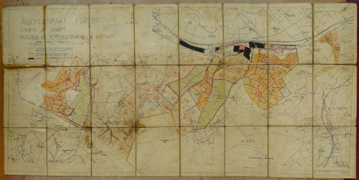
Rosarie Forest Planting Map
Maps are courtesy of Moray and Aberdeenshire Forest District.
The area that was known as Rosarie Forest is located in the old county of Banff mainly between Keith and Dufftown and was a Forestry Commission forest unit on its own prior to amalgamation. Interestingly the first name for the unit going by this map was Auchluncart Forest but the was likely renamed as Rosarie following the first planting in 1943 which was in an area known as Rosarie Wood or possibly from the office location in former days. Planting continued in the area into the 1950s as further acquisitions were added.
Interestingly the map was hand drawn in the East Conservancy Office in 1947 and may have been as a result of those additional land purchases. The compartment numbers do not run with the planting years and the local staff appear to have renumbered the compartments with the sequence running from east to west.
Any details about the woods or your work in these woods are very welcome.
Download Large Version (3.3MB)
Groups: Maps of Forest and Woodland Areas, Northeast Scotland