Forest Design Plan — Clashindarroch Forest
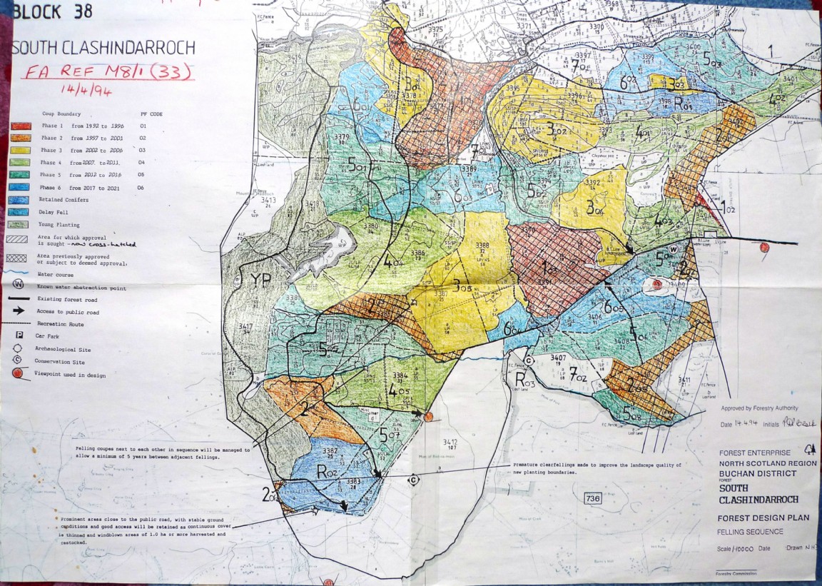
Map is courtesy of Moray and Aberdeenshire Forest District and is the Felling Sequence part of a 1994 Forest Design Plan for the area known as South Clashindarroch Forest. Note that Clashindarroch Forest was broken up into three Forest Design areas simply because the combined paper map area was too large to handle easily.
About 1992 the decision was taken that all Forestry Commission forests should to be processed into Forest Design Plans over a period of about five to six years. Quite an undertaking as the concept of landscaped and time designed felling coupes and replanting was new. Further also the whole process had to go out for consultation with Forestry Authority, Public Bodies such as District Councils, SNH etc as well as local people.
This was among the early completed Forest Design Plans for the then Buchan Forest District and was before the advent of GIS systems on District Computers. The concept of looking holistically at a forest and its potential attributes in terms of conservation, landscape and recreation values along with those of timber production and incorporating the findings into a Forest Design Plan had been only been around for a few years and had developed from the more simplistic landscape design plans of the mid 1980s. These plans may now be called Long Term Plans or something similar.
The large areas of maturing crops of trees which were reaching felling age were a strong driver for the production of the felling design plans that broke the potential areas up into landscape designed coupes and timed them so that consecutive felling coupes were separated from each other by at least five years. The cross hatching designated the areas which have been specifically approved for felling in the following five years.
At this point also mature conifers of conservation, recreation or even landscape value were considered for longer term rotations or for management under continuous cover systems (Noted as R on the plan).
The plan was signed off as approved by the Grampian Forestry Authority Conservator Douglas Clark in April 1994 but to have gone through the drawing and consultation process must have been initiated at least six to eight months earlier. Note the areas are all hand coloured with crayon pencils and text has been added by sticking on typed labels and strips. This author as then District Manager personally worked on the first few plans until a Forester (Donald Macleod) was trained and assigned full time to the task.
Groups: Maps of Forest and Woodland Areas, Northeast Scotland