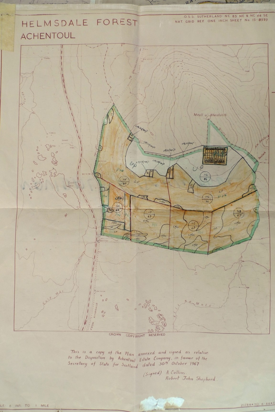
Achentoul plantation - Helmsdale Forest
Courtesy of North Highland Forest District, Golspie.
The map shows the extent of the planting in Achentoul Plantation around 1970. Interesting to note that the hill top is unplanted except for an experimental plot planted with Sitka spruce and Lodgepole pine. The compartment rides are no longer in grid iron lay out and some rides follow what could be main access routes; the Lodgepole pine species symbol (Now fully reverted from PC to LP) has a suffix (c) to indicate most likely coastal provenance seed. On the map also in the 1970 planting, the seed identification numbers of the Lodgepole pine have been added in some what looks like small trial plots. The Ident number 7987 and 7986 refer to North America but memory does not recall the location.
Lodgepole pine is extensively used most likely on all the deep peat areas but it is worth noting in the 1968 planting Sitka spruce and Hybrid larch were used in intimate mixture with Lodgepole pine in some compartments.
As usual with a national organisation there was a code and procedure convention for mapping of plantations some of which survive in the FC to this day. Acquisition boundaries were edged with a yellow ink (in this case green was used); compartment boundaries (rides) drawn in red ink; the extent of the planting in any year was given a light colour wash, outlined in green ink and the planting year written in green eg P.66; the compartment’s serial number and area in acres was written within the compartment sometimes within a small circle; the areas where different tree species were planted within each compartment were annotated with a species code eg SS (Sitka spruce), LP (Lodgepole pine) etc; different species areas in each compartment had to be separated by a dotted black line; internal fences, streams and other land usually indicated by a solid black line.
Note that the annual reporting year and the planting year coincided at this time in that they ran from 1st Oct to 30th Sep. This avoided having an artificial split in the totals for the planting season which ran from November through to May. The Planting Year (PY or just P) was fixed as the first summer following planting and thus trees planted in Nov 55 and May 56 were both annotated P56.
Download Large Version (1.3MB)
Groups: Caithness and Sutherland, Maps of Forest and Woodland Areas